|
page 119 ---navigation---weather---ocean birds---scientific
instruments and measurements---dangerous rocks---
But the farther we advanced to the south, the more perceptible was the
difference of the elements. In 13°29 south latitude, and 31°37
west longitude, the thermometer, at half-past seven in the morning, was
in the air at 19.50° R., in the water 20°; at noon, in the air
and water 20°; in the evening at half-past seven, in the air 19.25°,
in the water 19.75°; the hygrometer 61° to 70°; the araeometer
2.87° to 3°; the barometer 28° or 27.7° to 27.9°. In latitude 18° 4', and longitude 35°-20°, the warmth of the
atmosphere decreased nearly one degree, and the thermometer varied between
17° and 18°. We were now in the latitude of the Abrolhos,
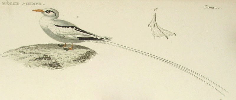
and the appearance of several sea-fowls (Phaeton
aethereus and Procellaria
capensis) indicated the vicinity of those dangerous rocks which
lie along the coast of Brazil between the 16th and 19th degrees of south latitude.
The captain ordered
soundings to be more frequently taken; and though no bottom was found
at less a depth than seven hundred feet, he judged it prudent to keep
farther off the coast during the night. The small coasting vessels which
sail backwards and forwards during the whole year between Bahia and Rio de Janeiro,
do not always keep to the east of that dangerous chain of shallows and
cliffs, but, when the wind is not favorable to carry them out to sea,
often remain very near the coast where they can safely pass the channel,
which is twelve miles broad, between the four small rocky islands, Ilhas Abrolhos.

Abrolhos Islands near the coast of Brazil
page 120 ---navigation---
This very frequent navigation has caused the Portuguese coasters to examine
a series of shallows from nineteen to fifty fathoms [114-300 feet], which, beginning
to the south of Bahia de
todos os Santos, extend along the coast of the Comarca
dos Ilheos from the Baixos de S. Antonio in the mouth
of the Rio Grande, in the direction of SSE, are connected with the Abrolhos,
properly so called, and stretch from their most easterly end in 18°38'
to 40' south latitude, and 36° west longitude of Greenwich, towards
the SE of the rocky islands of Trinidad and Martin Vas. One of the sea-faring people with whom we became acquainted at Bahia,
compared the 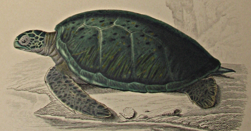 formation of the rocks at Trinidad to those of Madeira and the Canaries.
He was full of the impressions which had been left upon his mind by the
grandeur and boldness of the masses of rocks there, which destitute of
vegetation, except at the foot, rise perpendicularly out of the ocean,
but above all an immense rocky arch under which the sea breaks with great
fury. It is, however, very seldom that Portuguese vessels go from the
Brazilian coast as far as this longitude, and anchor near these inhospitable
cliffs to take in water, or to catch turtle which are said to be very numerous there. formation of the rocks at Trinidad to those of Madeira and the Canaries.
He was full of the impressions which had been left upon his mind by the
grandeur and boldness of the masses of rocks there, which destitute of
vegetation, except at the foot, rise perpendicularly out of the ocean,
but above all an immense rocky arch under which the sea breaks with great
fury. It is, however, very seldom that Portuguese vessels go from the
Brazilian coast as far as this longitude, and anchor near these inhospitable
cliffs to take in water, or to catch turtle which are said to be very numerous there.
 
|
